
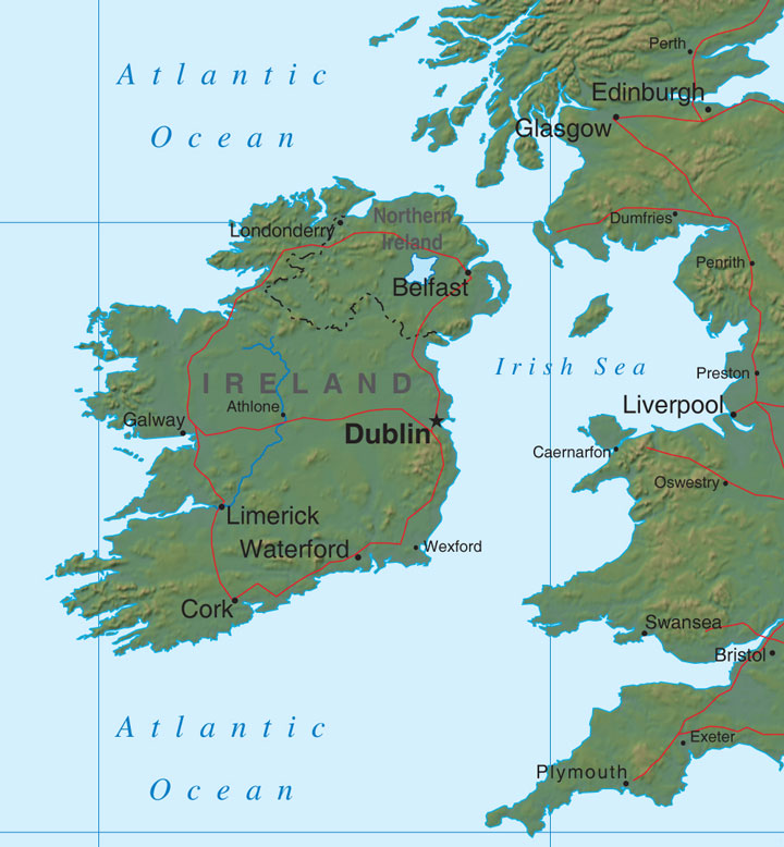
Ireland Relief Map
Map of Ireland > Ireland Locator Map • Ireland Travel • Ireland Relief Map • Dublin Map
 Most of Ireland is made up of low-lying limestone plains, with plenty of
hilly areas and fertile soils scattered throughout. The country is
so fertile that Ireland is known for its brilliant green landscape.
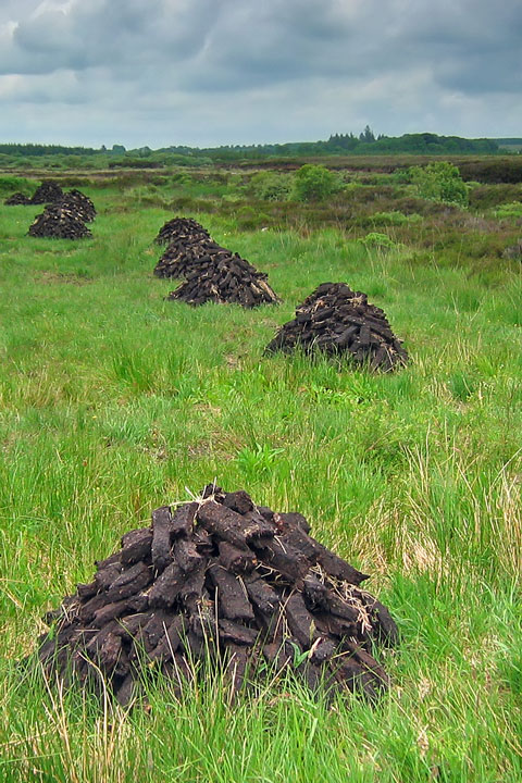
There are many bodies of water throughout the land; specifically, the
countryside is home to many small lakes and peat bogs. The country's
largest river, the Shannon River, drains the central plain of Ireland
and runs through many of the country's larger lakes.
Most of Ireland is made up of low-lying limestone plains, with plenty of
hilly areas and fertile soils scattered throughout. The country is
so fertile that Ireland is known for its brilliant green landscape.
There are many bodies of water throughout the land; specifically, the
countryside is home to many small lakes and peat bogs. The country's
largest river, the Shannon River, drains the central plain of Ireland
and runs through many of the country's larger lakes.
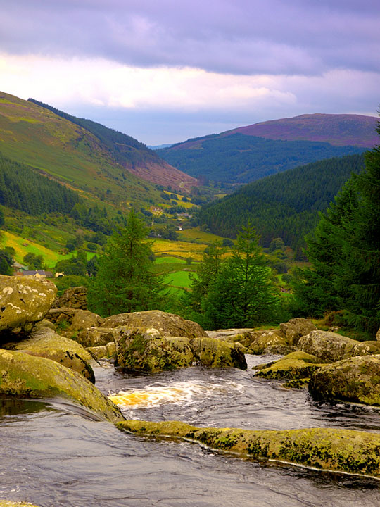 There are several mountain ranges dotted along Ireland's majestic
coastline, including the Wicklow Mountains in the southeast and the
Macgillycuddy's Reeks in the southwest.
There are several mountain ranges dotted along Ireland's majestic
coastline, including the Wicklow Mountains in the southeast and the
Macgillycuddy's Reeks in the southwest.
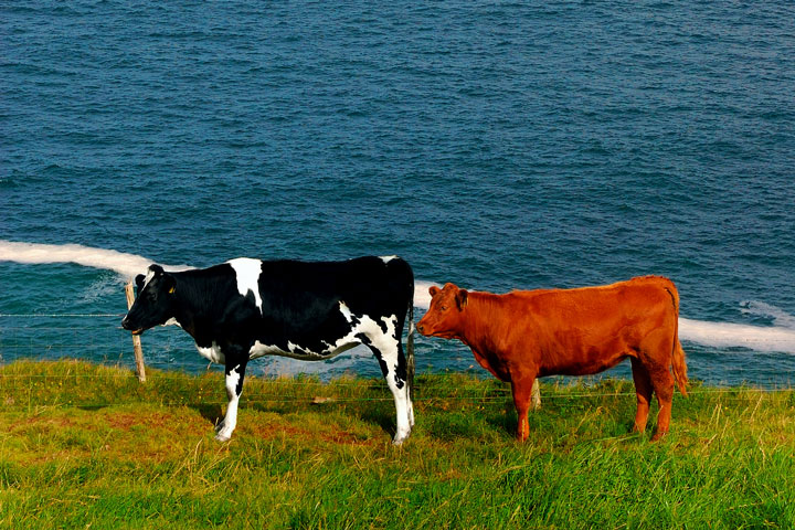 While Ireland's land has traditionally been used to support its economy
through agriculture, the country has moved away from that model in favor
of manufacturing and processing. However, agriculture still employs
about one in eight workers in Ireland. Livestock and dairy farming
is still fairly robust in the country, while crops such as potatoes,
barley, and wheat are also grown on Irish soil.
While Ireland's land has traditionally been used to support its economy
through agriculture, the country has moved away from that model in favor
of manufacturing and processing. However, agriculture still employs
about one in eight workers in Ireland. Livestock and dairy farming
is still fairly robust in the country, while crops such as potatoes,
barley, and wheat are also grown on Irish soil.